The best trails for breathing fresh air in Braga
Braga is a very familiar city with good leisure options on a daily basis. There are many parks, public squares, trails, viewpoints, leisure complexes, history, culture ...
The Pedestrian Network of Braga, promoted by the Braga City Council, totals about 280km of trails, which run through the entire county passing through hills, valleys, rivers and also through the city. There are trails for all types of hikers, with different difficulties, distances and points of interest.
We Braga shared some tracks and we decided to reproduce to stay up to date!
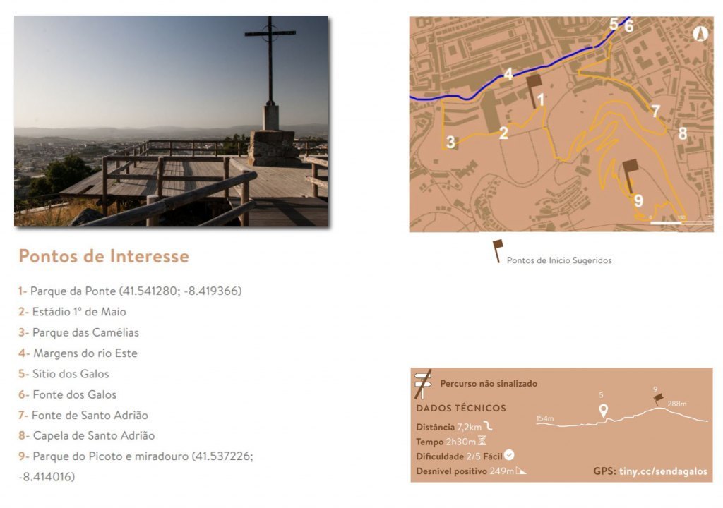
On the path of the Roosters:
From the wide panoramic view from the top of Monte do Picoto, this route unfolds, trying to cover a natural environment that covers the parks of Picoto, Ponte, Camélias, as well as the Ecovia of the Este river. Walkers are advised to take a close look at the details that appear along the route, whether related to heritage as well as fauna and flora.
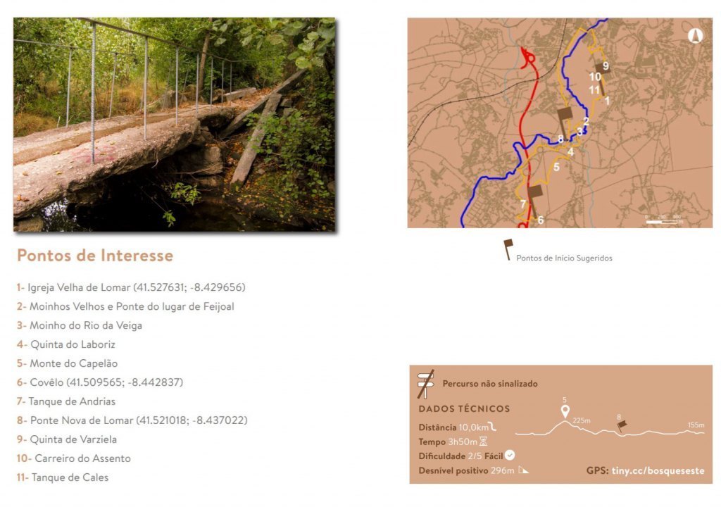
Forest Trail of the East River:
On its path along Braga, as soon as it reaches the end of the urban area, the Este river widens its banks and starts to run through a totally natural environment. Around it, several riverside species occur, such as, among others, alders, birches and poplars. The flora is joined by the fauna, with the sight of some species of birds.
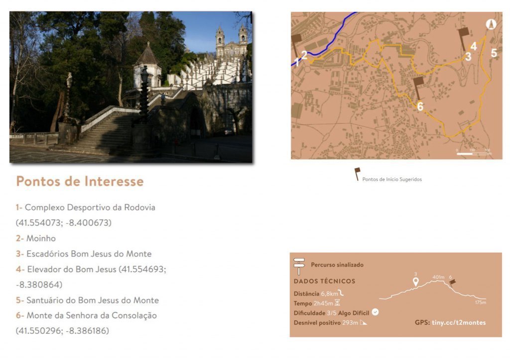
Dois Montes Trail:
Between the Sports Complex of the Highway and the surroundings of the Sanctuary of Bom Jesus, by peculiar paths that “run away” from the main road and that cross some of the most traditional sites of Nogueiró and Tenões, the “Trilho dos Dois Montes” provides an experience of discovery of an environment full of emotion, due to the subtle details that reveal themselves exuberant when discovered.
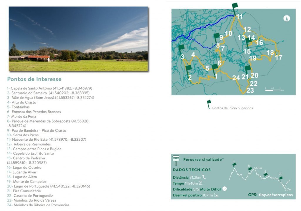
Great Route of the Serra dos Picos:
Under the embrace of Sameiro with the Serra dos Picos and the charming and refreshing river of Várzea and streams of Provências and Reamondes, appears the zone of highest average altitude of Braga, in the parishes of Espinho, Sobreposta and Pedralva. Among mountain ranges, valleys and places where almost nothing escapes the feeling of seeming to have important heritage significance, an aura is captured, reminding us a bit of the Gerês or Peneda mountains, in an experience of tranquility and communion with the surrounding that fills the soul of who comes here.
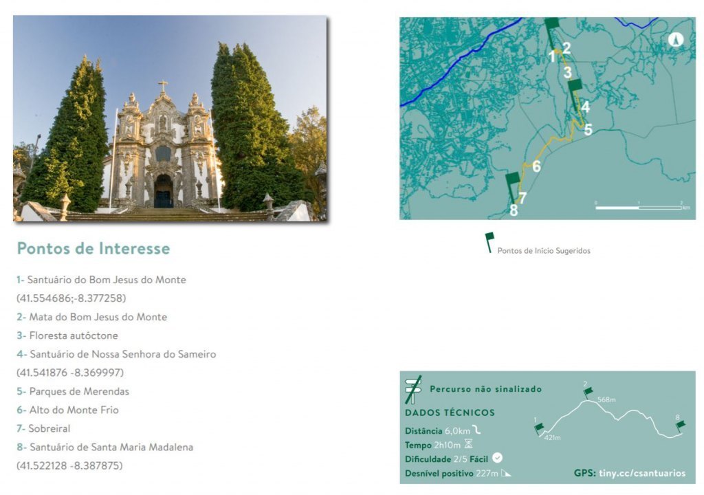
Way of the Shrines:
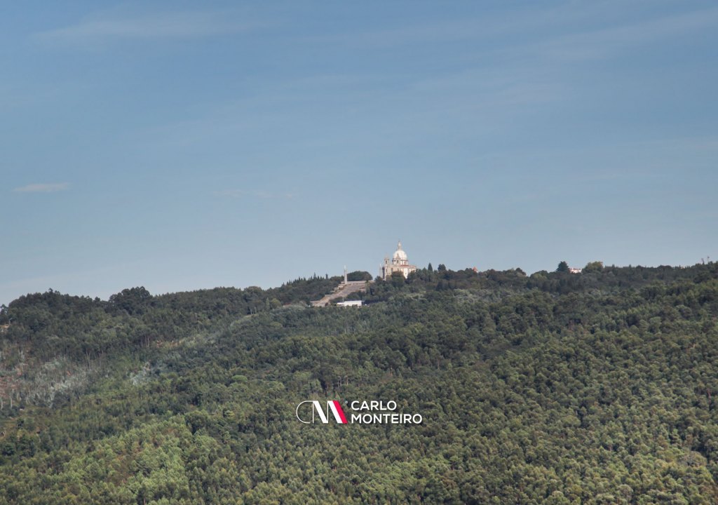
At the top of the hills overlooking the city of Braga, three sanctuaries stand out in the landscape: the Bom Jesus do Monte Sanctuary, the Nossa Senhora do Sameiro Sanctuary and the Santa Maria Madalena Sanctuary. They are not only larger places of religious worship, but also spaces of choice for leisure and rest. Here, the exceptional architectural and historical richness is matched by a charming natural environment that joins the Bom Jesus forest, patches of native and panoramic forest that cover the city of Braga and the entire surrounding region up to the Atlantic Ocean.
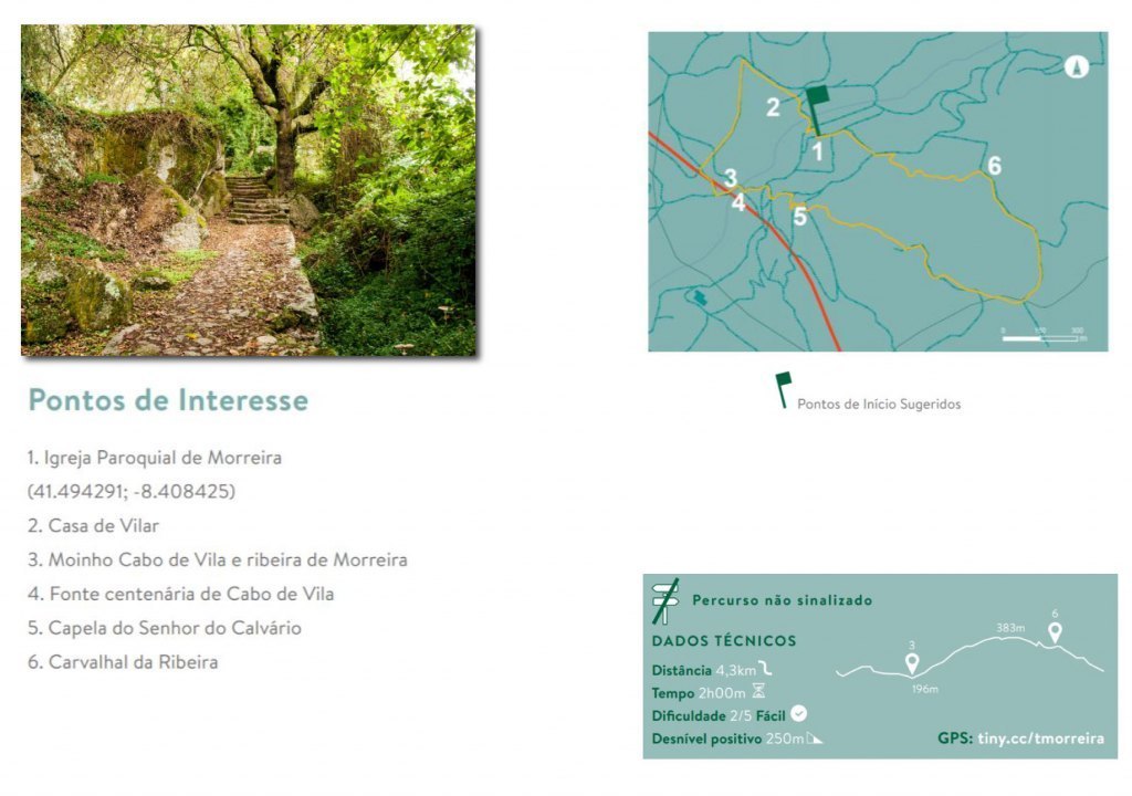
Morreira Trail:
The valley of the Morreira stream and the mount of Senhora da Saúde comprise a charming but still little-known environment, which a walk will reveal in all its splendor. It is a short route, of medium difficulty. There are several points of interest to be appreciated. A climb to the mount of Senhora da Saúde illustrates an image of what is typically Minho's surroundings.
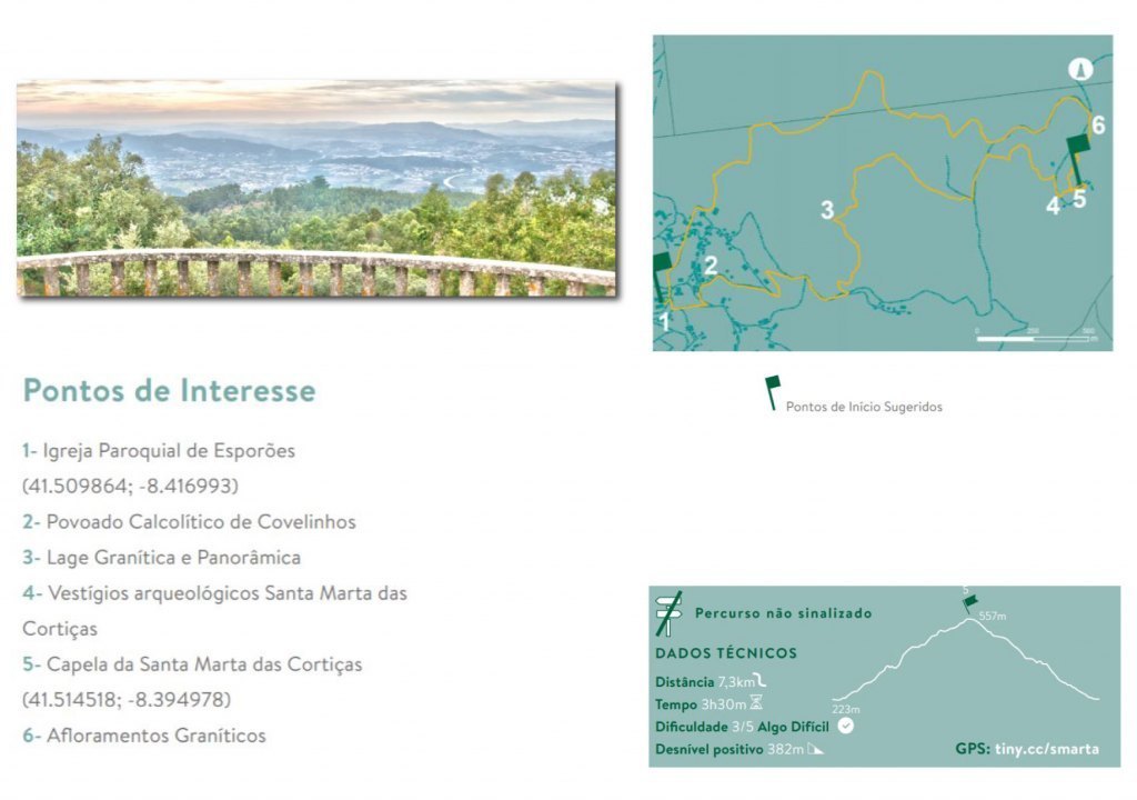
Santa Marta das Cortiças Trail:
At 562 meters of altitude, a small chapel devoted to Santa Marta, surrounded by leafy cork trees, gives the name to a place of unique historical importance: Santa Marta das Cortiças, whose vast and transversal archaeological heritage, which is still discreetly kept in underground, it shows marks that go back to the 8th century BC The oldest archaeological finds found on the highest mountain platforms are from that distant time, to which others are added, such as the remains of a castro (which came to be romanized), of a Basilica from the beginnings Christianity dating from the 5th and 6th centuries;
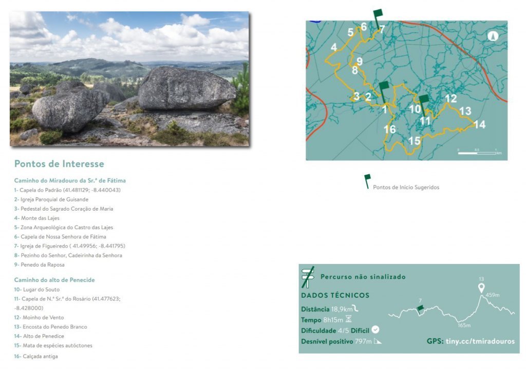
Viewpoint Trail:
In search of unraveling the secret of the unique locations from which to contemplate landscapes that stretch between the banks of the Minho and Douro rivers, along the entire Minho coast line between Galicia and the Douro Litoral, or a unique view over the city of Braga from the south and Veiga de Penso, this route crosses forests, fields and rural areas.
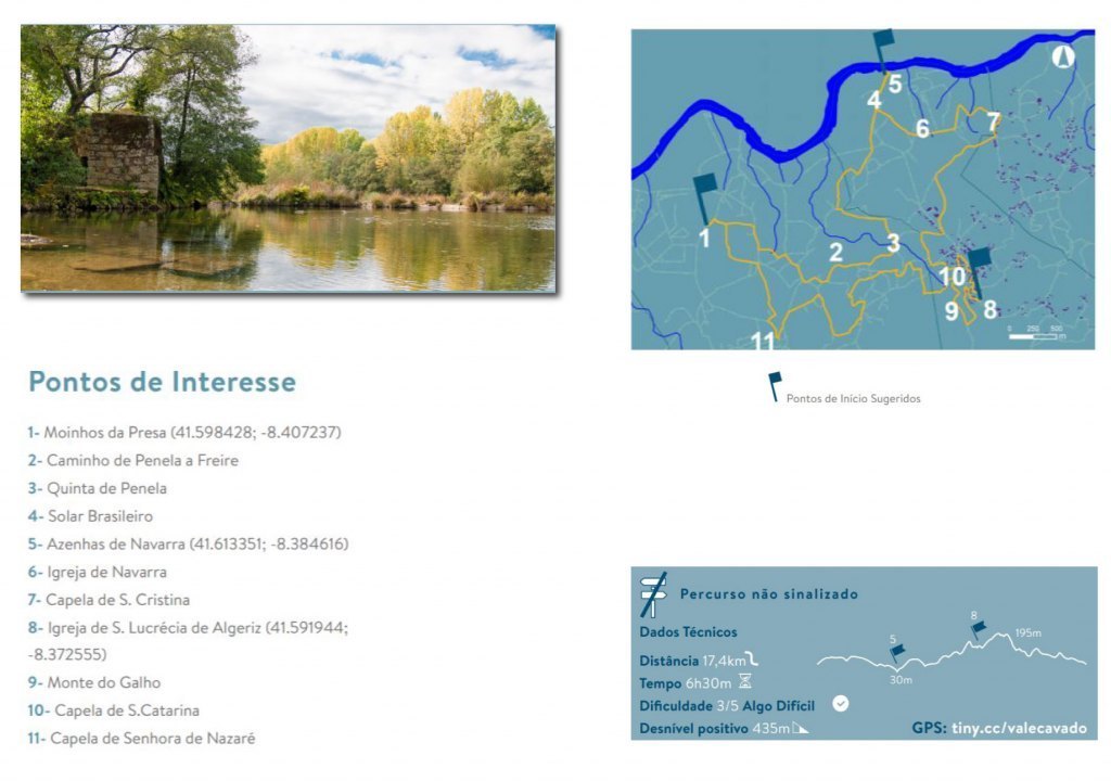
Through the Cávado Valley:
The Cávado River rises in the Serra do Larouco, in the municipality of Montalegre, and travels 135km until it flows into the Atlantic Ocean, in Esposende. The river and the economic activities associated with it, are identities of the parishes that mediate it with the city of Braga. Here, the contrast with mountainous parishes, such as Sobreposta and Pedralva is evident, with more open views, larger properties and relatively smooth slopes.
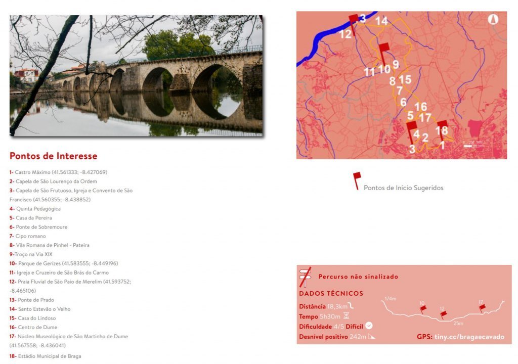
Between Braga and Cávado:
This route poses the challenge of remembering unique elements of History, connecting the urban area of the municipality of Braga to the Cávado River, through a route in the vicinity of Via XIX. There are about 18km, in a circular path, where the walker can feel the magnitude of the historical heritage of the city of Braga.
Undoubtedly, it is worth trying to live in Braga and take advantage of what Braga has to offer: wine, natural beauty and gastronomy. We hope that your new life experience will be even better. So, welcome to Braga!
Source: webraga.pt / cm.braga


* Call to national mobile network.